Flexible, Data-Driven Pricing for Smarter Farming
We provide affordable, scalable pricing for farms of all sizes—whether you need a one-time aerial assessment or ongoing crop monitoring. Our transparent, per-acre pricing model ensures you only pay for what you need, helping you maximize yield, reduce costs, and improve efficiency with precision drone technology.
Subscription Model
Ideal for farmers who require regular updates on crop health, soil moisture, and pest control throughout the growing season.
See Pricing at the bottom of the page.
Hourly Rate Pricing
Perfect for consulting, small farms, or specialized projects requiring quick assessments.
£60 per hour (Minimum booking: 2 hours)
✅ Covers up to 50 acres per flight
✅ Includes raw images + basic report
✅ Additional detailed reports available at an extra cost
Per Acre Pricing
Designed for large farms requiring full-field assessments.
✅ Ideal for farms covering 100+ acres
✅ Bulk discounts available for 500+ acres
See pricing at the bottom of the page.
Individual Service Pricing & Deliverables
For farmers looking for one-time assessments, we offer standalone pricing for each of our core services.
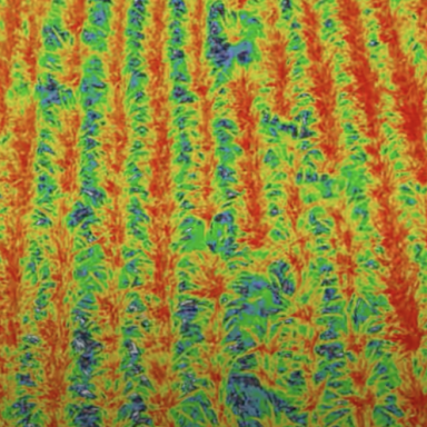
Crop Health & Growth Analysis
Price starting from £180 for small farm
✅ Drone flight + multispectral imaging
✅ NDVI heatmap with crop stress analysis
✅ Detailed PDF report with recommendations
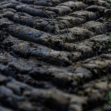
Soil & Irrigation Mapping
Price starting from £180 for small farm
✅ High-resolution soil moisture map
✅ Identify dry spots & irrigation inefficiencies
✅ PDF report with recommended actions
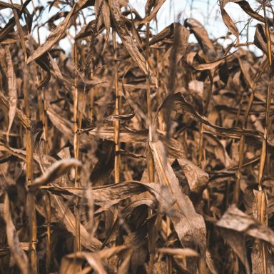
Field Damage & Risk Assessment
Price starting from £180 for small farm
✅ Pre- and post-damage aerial imagery
✅ Detailed damage assessment map
✅ Actionable insights for replanting & insurance claims
Precision Input Mapping
Price starting from £180 for small farm
✅ Prescription map for targeted application
✅ Optimize chemical use & reduce costs
✅ Custom GIS map for variable-rate application

Subscription Model
Essential Plan
✅ Services: Crop Health & Growth Analysis + Soil & Irrigation Mapping
📏 Coverage: Up to 100 acres
💰 Monthly Price: £300/month
🔹 Ideal for small to medium farms looking for basic NDVI analysis & soil moisture mapping to optimize crop growth & irrigation efficiency.
Advanced Plan
✅ Services: Crop Health & Growth Analysis + Soil & Irrigation Mapping + Field Damage & Risk Assessment
📏 Coverage: Up to 250 acres
💰 Monthly Price: £750/month
🔹 Designed for larger farms needing continuous crop health monitoring, precision irrigation insights, and field damage assessments to detect pests, weeds, and weather damage early.
Premium Plan
✅ Services: Full farm monitoring – All 4 services included
📏 Coverage: Up to 500 acres
💰 Monthly Price: £1,500/month
🔹 The most comprehensive plan, covering NDVI crop health analysis, soil moisture mapping, damage assessments, and precision input mapping for large-scale precision agriculture operations.

Per Acre Pricing (60+ Acres)
£3 per acre
✅ Straightforward pricing for farms over 60 acres
✅ Custom discounts available for 1,000+ acre farms
Custom Packages & Bulk Discounts
🔹 Multi-Service Bundles – Save when combining NDVI, soil moisture, and pest detection
🔹 Seasonal Contracts – Lower rates for repeat customers
🔹 Enterprise Solutions – Large-scale farms (500+ acres) custom pricing available
Contact us for a tailored quote!
Why Choose Altitude Drones?
✅ Affordable, flexible pricing for all farm sizes
✅ High-precision data for better decision-making
✅ Local, expert service with quick turnaround
Book Your Drone Survey Today! 🚜
©Copyright. All rights reserved.
We need your consent to load the translations
We use a third-party service to translate the website content that may collect data about your activity. Please review the details in the privacy policy and accept the service to view the translations.