
Advanced Drone Solutions for Precision Agriculture
Harness the power of multispectral drone technology for real-time insights into crop health, soil conditions, field damage, and input mapping. Our precision data helps you maximize yield, reduce costs, and make smarter farming decisions.
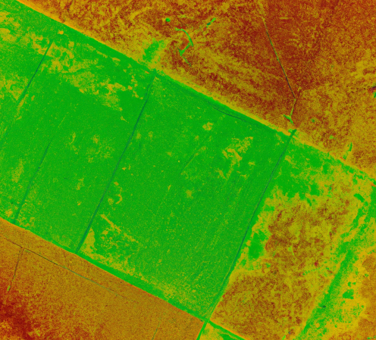
Crop Health & Growth Analysis
What It Offers:
 Early detection of crop stress (nutrient deficiencies, disease, or drought)
 Monitor seasonal crop growth & yield trends
 Generate NDVI and multispectral maps for decision-making
How It Works:
 Our DJI Mavic 3 Multispectral collects 5-band multispectral data, analyzing vegetation health and chlorophyll levels. We process the images in Pix4Dfields or DJI Terra, generating NDVI maps that highlight areas of plant stress or poor growth. Reports are delivered digitally, helping farmers adjust fertilization, irrigation, or treatments accordingly.
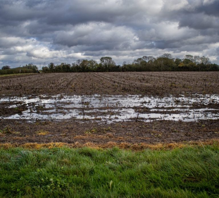
Soil & Irrigation Mapping
What It Offer:
 Identify over- and under-watered areas for precise irrigation management
 Detect soil compaction, drainage issues & field variability
 Optimize water usage & prevent drought stress
How It Works:
The Mavic 3 Multispectral captures multispectral and RGB imagery to assess soil moisture distribution and field uniformity. Using Pix4Dfields and Agisoft Metashape, we create high-resolution moisture maps, revealing dry spots, runoff issues, and drainage inefficiencies. Farmers receive detailed irrigation insights, allowing them to adjust watering schedules and reduce waste.
Field Damage & Risk Assessment
What It Offers:
 Assess storm, flood, or frost damage quickly
 Detect pest infestations & weed overgrowth early
 Plan replanting efforts based on accurate field damage maps
How It Works:
After weather damage, pest outbreaks, or weed infestations, our DJI Mavic 3 Multispectral conducts low-altitude and high-resolution scans over affected fields. The captured multispectral imagery is processed in Pix4Dfields and WebODM to create damage reports, weed/pest heatmaps, and replanting recommendations. Farmers receive GIS-integrated data & PDF reports, helping them plan recovery and optimize field treatments.
Precision Input Mapping
What It Offers:
Generate targeted fertilizer & pesticide prescription maps Reduce input costs by applying treatments only where needed Optimize field productivity through variable-rate application maps
How It Works:
The Mavic 3 Multispectral collects high-accuracy NDVI and multispectral images, detecting crop nutrient deficiencies and pest zones. We use DJI Terra and Pix4Dfields to create precision agriculture maps for variable-rate spraying and fertilization. Farmers receive detailed application zones, which can be uploaded to farm machinery for GPS-guided treatment.
©Copyright. All rights reserved.
We need your consent to load the translations
We use a third-party service to translate the website content that may collect data about your activity. Please review the details in the privacy policy and accept the service to view the translations.